Forge east from the civilizations of Salt Lake City or Park City, Utah and you’ll see the Uinta Mountains long before you arrive to them. The range stretches west-to-east, beginning as conifer-covered ridges that reach leisurely toward a tree-less core of summits. Unlike Utah’s Wasatch Mountains, which claw into the heavens with peaks that resemble dinosaur teeth, the profile of the Uinta Mountains is more like that of a pod of curvy-backed whales.
")
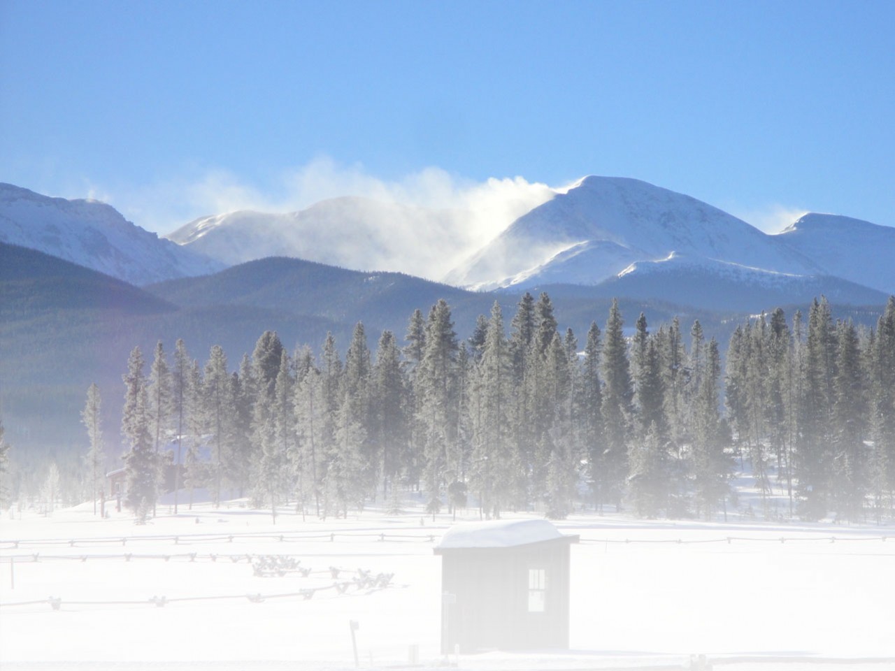
Bryon Powell snowshoes through leafless aspen trees and along the Norway Flat Road in the western Uinta Mountains (Meghan M. Hicks photo credit).
Don’t mistake these mountains and their rounded edges as short, though. They contain Kings Peak, Utah’s tallest, and a couple dozen other peaks over 11,000 feet in elevation. By both summer and winter, the Uinta Mountains and their altitude are a playground for recreationists of almost every kind.
The Mirror Lake Scenic Byway dissects the western half of the mountains roughly north-to-south. Think of this highway, the only paved road that traces through the range’s high-elevation core, as a diving board for mountain play. In the winter, the highway’s highest elevations are closed to wheeled vehicles and maintained for snowmobile traffic. However, as the lower portion of the road climbs out of Kamas, Utah, into the western Uinta Mountains, and toward that winter-road closure, it provides car access to a variety of snowshoeing routes.
The western side of this range is just 30 minutes from downtown Park City and an hour from Salt Lake City, but it’s a veritable world apart from these metropolises. A few miles beyond Kamas, the Uinta Mountains become service-less, uninhabited, and quiet. A day or more of snowshoeing here is what I call walking on the wild side.
Snowshoe Here
A dozen or so options for snowshoeing exist along the Mirror Lake Scenic Byway between Kamas and the winter road closure. Here are some of my favorites listed in order of increasing difficulty in terms of their surface, navigability, and steepness.
Beaver Creek Trail– You’ll encounter this trail first as you drive east from Kamas on the Mirror Lake Scenic Byway. The trail runs west-to-east and just south of the road for about six miles one-way between the Yellow Pine and North Fork Trailheads. During the bulk of winter, the trail is groomed a couple times per week. It rolls gently and is a perfect place for beginning to intermediate snowshoers.
Pine Valley Trail– Access this ungroomed, beginner to intermediate snowshoeing trail at the Pine Valley Road. The trail travels south from the Mirror Lake Scenic Byway for about 2.5 miles one-way. It’s mostly rolling with a couple steep sections.
Yellow Pine Trail– The Yellow Pine Trail wends north from the Yellow Pine Trailhead for many miles. This ungroomed trail is an intermediate route for the first two miles and it yields outstanding views of the wide drainage through which you’ll be snowshoeing as well as the Uinta Mountains to your north. After two miles, the drainage significantly narrows and the trail steepens. Travel beyond this point is for advanced snowshoers with knowledge of and proper equipment for travel through avalanche terrain. Return to the trailhead the way you came.
Norway Flat Road– Park at the Pine Valley Road and go north on the Norway Flat Road. This forest service road, a dirt road in the summer, gradually climbs into the higher reaches of the Uinta Mountains. For the first five or so miles, the wide roadbed is an intermediate route offering views of Pine Valley to the south. Travel beyond the five-mile point is for advanced snowshoers with knowledge of and proper equipment for travel through avalanche terrain. Return to the trailhead the way you came. The Norway Flat Road is open to but rarely used by snowmobilers.
")
While snowshoeing on the Norway Flat Road, Bryon Powell walks on the wild side (Meghan M. Hicks photo credit).
Mine Trail– Access the Mine Trail from the Yellow Pine Trailhead by snowshoeing along the Beaver Creek Trail for approximately one mile. Turn right onto the trail and then climb this advanced route up to mining ruins that include a ramshackle cabin and equipment. For your hard work on this ungroomed, steep trail, you’ll also gain views of the western Uinta Mountains as well as the Wasatch Mountains to the west. Local snowshoers who are familiar with the terrain connect to other trails using an unmarked route from the mine ruins, but this is not recommended for first-time visitors. It’s a little over three miles one-way from the Yellow Pine Trailhead to the mine ruins.
Taylor Fork and Plantation Trails Loop– Park at the Shingle Creek Campground and snowshoe east on the Beaver Creek Trail for a half-mile until you reach the right-hand turnoff for the Plantation Trail. Snowshoe up this ungroomed, advanced-level trail for under one mile until you intersect the Taylor Fork Trail. Turn right on the Taylor Fork Trail and return downhill to the Beaver Creek Trail just west of the Shingle Creek Campground. From high points on this loop, you’ll glimpse views of the Uinta Mountains to your north. The whole loop is around three miles.
Tips for Snowshoeing in the Uinta Mountains
Be Prepared– The Uinta Mountains are a wild place with little in the way of services. Don’t do something silly and end up in the middle of nowhere without what you need to stay safe, warm, and well fed. Literally, the only place to acquire goods once you leave downtown Kamas is the Samak Smoke House and Country Store. Located 2.5 miles east of downtown Kamas on the Mirror Lake Scenic Byway, this establishment serves sandwiches and coffee, has a shop full of snacks, smokes and sells a variety of meat, and offers snowshoe and other gear purchases and rentals (samaksmokehouse.com, 435-783-4880).
Etiquette– The Beaver Creek Trail is groomed for both cross-country skiers and snowshoers. Please respect all users by walking on the outer edge of the groomed track. Some of the ungroomed trails are used by skiers as well. If you encounter a ski track on an ungroomed trail, kindly snowshoe to one side of it.
Guided Snowshoeing Trips– If you wish to tackle the wild side of the Uinta Mountains with a guide, hire one in Park City, Utah. The good folks of White Pine Touring offer full-day, private snowshoe trips to the western Uinta Mountains (whitepinetouring.com, 435-649-6249).
Rules, Fees, and Maps– You’ll be snowshoeing in the Uinta-Wasatch-Cache National Forest’s Heber-Kamas Ranger District. Please follow the rules of the national forest. In addition, the national forest charges a $6 entry fee per vehicle, which is good for three days. This is payable at a fee station located on the Mirror Lake Scenic Byway. You can acquire maps and other information about snowshoeing on forest lands there, too. Be smart and take a map wherever you plan to snowshoe (fs.usda.gov/uwcnf, 435-654-0470 or 435-783-4338).
Follow us for the latest news!